
News Summary
Bowling Green is expecting heavy rain and potential flooding this weekend, with forecasts predicting 3 to 6 inches of rainfall. Residents are advised to stay alert for flooding on local roads as a flood watch has been issued by the National Weather Service. Strong winds may accompany the rain, while subsequent rain is expected early next week. Residents are encouraged to adjust weekend plans and prioritize safety against flooding.
Weather Alert: Heavy Rain and Flood Watch for Bowling Green This Weekend!
Bowling Green residents, it looks like we’re in for quite a soggy weekend! Heavy rain is expected to sweep through the area starting overnight and continuing right into Sunday. The National Weather Service in Louisville has placed the entire District 3 under a flood watch, which means we all need to stay alert and be prepared for potential trouble on the roads.
What You Need to Know
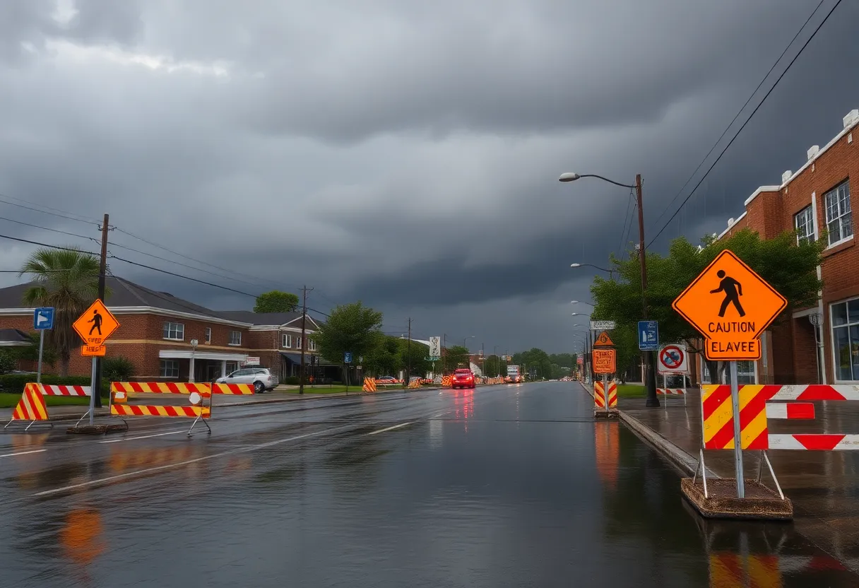
So, what’s the forecast? District 3 is bracing for about three to four inches of rain this weekend. Yes, you read that right! Flooding could be serious, especially on roads that typically stay dry. It’s a good idea to keep an eye out for water over roadways and to avoid any driving through what looks like high water.
County crews are standing by, ready to spring into action if needed. But remember, road conditions can change quickly in heavy rain. Just because you don’t see a barricade at the end of a road doesn’t mean it’s safe to pass. Stay safe, and whatever you do, don’t move or drive around those barricades!
First Alert Weather Day
Saturday has been dubbed a First Alert Weather Day because of the heavy rainfall expected. In fact, the forecast anticipates total rainfall of 3 to 6 inches across the area. That means we should brace ourselves for possible flooding along rivers, streams, and in those pesky poor drainage areas.
As the rain picks up, you might also feel some strong, gusty winds blowing, as a cold front moves in. Fortunately, the risk of severe weather is still low, but we can expect some torrential rainfall late Saturday night, bringing with it a drop in temperatures, which may even lead to a bit of wet snow on Sunday. However, no significant issues are expected from this wintry weather.
Looking Ahead
As we gear up for potential wetness this weekend, it’s worth noting that we might not be out of the woods just yet! A separate flood watch has been issued for Monday evening through late Tuesday due to anticipated heavy rainfall in south-central Kentucky, including Warren and Barren counties. An additional 1 to 2 inches of rain could be on the way, compounding the issues from the weekend.
The ground is already saturated from previous rainfall, meaning that flood-prone areas and low-water crossings may become impassable. If you see high water, remember that turning around is better than drowning. Always stay aware, and avoid walking or driving through flooded areas.
Weekend Plans? Adjust Accordingly!
So, if you had plans this weekend, it might be wise to consider some indoor activities instead. Stay tuned for weather updates, and keep checking local social media accounts for information about road closures. Remember that your safety comes first, so if you see murky waters ahead, just turn around!
Next week looks like it will bring even colder temperatures, with highs dropping down into the 20s and lows dipping into the teens and single digits. Snow showers may also pop up mid-week, adding a bit of chill to the already rainy weather.
Stay safe and keep those umbrellas handy, Bowling Green! With all this rain on the way, it’s good to be prepared. Be smart out there, and keep watching the skies!
Deeper Dive: News & Info About This Topic
HERE Resources
Southern California Braces for Severe Storms and Mudslide Threats
Two Winter Storms Looming Over the U.S. This Week
Major Winter Storm Set to Hit Northeastern U.S.
Winter Storm Alert: Prepare for Heavy Snow Over Super Bowl Weekend
South Central Kentucky Faces Flooding Crisis
Six Americans Released from Venezuelan Detention
Looming Trade Tariff Dispute: Implications for Great Lakes Commerce
Bowling Green Faces Indefinite Suspension of Refugee Arrivals
Southern California Braces for Much-Needed Rain
Welcome Rainfall on the Horizon for Southern California
Additional Resources
- WBKO: Flooding Likely Saturday
- Wikipedia: Flood
- Country Herald: Kentucky Flood Watch
- Google Search: Bowling Green weather
- WBKO: Gusty Winds & Flooding Potential Today
- Google Scholar: Flood Management
- WNKY: Sinkhole Opens in Bowling Green
- Encyclopedia Britannica: Flood Prevention
- WBKO: First Alert Weather Day
- Google News: Flood Watch