
News Summary
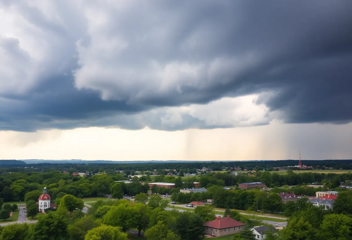
Bowling Green, KY, is currently under a flood watch due to expected rain and thunderstorms. Isolated showers may impact the area into the night and a higher precipitation chance is predicted for Monday afternoon. Residents are advised to stay alert, especially in flood-risk areas, as heavy rains may lead to flash flooding. Temperatures are set to rise into the 90s later in the week, coinciding with the official start of summer, while a slight risk for severe weather looms.
Bowling Green, KY is under a flood watch due to anticipated rain and thunderstorms. Isolated showers are expected to continue late into the night, with scattered rain likely on Monday morning and a higher chance of precipitation in the afternoon and evening. The National Weather Service has advised residents to remain vigilant, particularly in flood-prone areas, as slow-moving thunderstorms could lead to flash flooding.
High temperatures for Monday are expected to reach the upper 80s, with the weather pattern changing as a cold front moves through the area on Tuesday. This transition will bring a few isolated showers and storms but will also introduce slightly drier air, reducing humidity levels for a few days, leading to a more comfortable late-week weather experience.
As the week progresses, dry, hot conditions are forecasted for the end of the week. Temperatures are projected to climb into the lower 90s by Friday and will likely remain elevated throughout the holiday weekend. With summer officially starting, the weather is expected to be favorable for outdoor activities, including BBQs and pool parties, despite a slight increase in humidity over the weekend.
Currently, the flood watch extends across much of south-central Kentucky due to the likelihood of heavy rain from thunderstorms. Residents are urged to stay updated on weather conditions and to avoid driving through flooded roadways. Throughout the week, scattered thunderstorms will continue to occur, particularly on Wednesday when a slight risk for severe weather has been issued, mainly affecting the northwestern areas. The primary hazards include heavy rainfall and gusty winds.
Looking ahead, the forecast predicts warmer conditions as summer officially begins on Friday, bringing sunny skies and highs in the lower to mid-90s. A marginal risk for severe weather remains in effect, specifically for Friday afternoon, as the region could experience strong storms characterized by damaging winds, isolated hail, and heavy rain. The Storm Prediction Center has categorized this risk as level two out of five.
On Saturday, storm conditions may persist, prompting another slight risk assessment from meteorologists, particularly impacting the southern half of Kentucky. As the weekend wraps up, drier air is expected to settle in, lowering overall rain chances and leading to clearer skies on Sunday, although a slight chance for isolated showers and thunderstorms remains.
The weekly forecast shows some fluctuations in temperature, with a notably cooler day anticipated on Monday with a low of 66°F and a high of 76°F. Morning showers and storms are likely to continue through lunchtime, presenting a 40% chance of precipitation. On Tuesday, the weather is expected to clear somewhat, bringing partly sunny skies with a low of 52°F and a high of 76°F, alongside a lower chance of isolated showers (20%).
As the week progresses into Monday, rain chances will return, but these are expected to decrease again by the following Tuesday. Residents of Bowling Green are encouraged to keep informed about the quickly changing weather conditions and prepare accordingly for fluctuating temperatures and potential severe weather throughout the week.
Deeper Dive: News & Info About This Topic
HERE Resources
Tropical Storm Barry Brings Heavy Rain and Flooding Threat to Eastern Mexico
Bowling Green Man Charged Following Police Pursuit
Bowling Green to Host Thunder Fest
Thousands of Motorists Left Stranded by Mudslide on West Virginia Turnpike
Heat Alerts Across 20 States as Summer Sizzles On
Bowling Green Celebrates 3rd Annual Duncan Hines Days
Lightning Strike Injures 20 People at South Carolina Beach
Extreme Heat Dome Blankets Eastern U.S.
Salvation Army Provides Shelter During Extreme Heat in Bowling Green
Unbearable Heat Wave Overtakes Central and Eastern U.S.
Additional Resources
- WBKO: Scattered Showers and Storms Continue
- Wikipedia: Weather
- WBKO: Scattered Showers and Storms Monday Morning
- Google Search: Weather Forecast
- WBKO: Storm Chances Ahead
- Google Scholar: Weather Patterns
- WBKO: Spotty Shower or Storm Possible into Sunday
- Encyclopedia Britannica: Weather Conditions
- WBKO: Forecast Rain Showers Tonight and Tuesday
- Google News: Severe Weather